By the end of the 1980's the world of heavy metal glam-rock had become pretty nameless and faceless. The last round of bands scoring contracts with the major labels all seemed to be cut from the same fabric. It was becoming increasingly tough to tell one band from the next. Metal Edge magazine was packed cover to cover with all the latest groups, each trying to outdo the next by seeing who had to biggest hair or wore most make-up.
Although Enuff Z'nuff fit the image of what was going on at that time, their music put them in a different league all their own.
Hailing from Blue Island, IL Enuff Z'nuff was formed by bassist Chip Z'nuff and lead vocalist/guitarist Donnie Vie. The band got their start as Enough's Z'nuff in 1984 and quickly recorded a demo of original material. The band gained a quick following around the Chicago area playing clubs and their song "Fingers On It" received strong local airplay.
The band went through a few line up changes during their early years but by 1988 lead guitarist Derek Frigo and drummer Vikki Fox had rounded out what would become known as the classic Enuff Z'nuff line up.
The band eventually signed to Atco records and released their self titled debut album on August 22, 1989.
The album's first single "New Thing" was accompanied by flashy video tailor-made for the glam rock that was a staple on MTV. The video was in heavy rotation and followed by another glamtastic video for the album's power ballad and biggest hit "Fly High Michelle." Elsewhere on the record you will find uptempo rockers like "Kiss The Clown," "Little Indian Angel" and "Hot Little Summer Girl." There were no more singles pulled from the record but there were at least three more tracks that should have been hits: "I Could Never Be Without You," "For Now" and "She Wants More" are all standout tracks from the record.
While the band's image was all glam there was an undercurrent of psychedelia that set them apart from all the other acts of the day.
Musically they were a blend of The Beatles, Kiss, Cheap Trick, Slade and Van Halen. Guitarist Derek Frigo pushed their sound in more of a heavy metal style but underneath it all Enuff Z'nuff were a Power Pop band. Frigo once commented that without his guitar playing the band was basically be the Bay City Rollers.
I'll admit that I am a fan of The Rollers but there is much more depth to the music that Enuff Z'nuff were creating. Their sound would be fully realized on their next album, Strength, but their debut laid out the groundwork and was the perfect late summer record. It was full of hooks and harmonies and the energy was in the grooves.
Enufff Z'nuff captured the attention of some industry heavyweights who all had great things to say about the band.
Rolling Stone magazine called them "the next big thing" and "heavy metal Beatles."
The band also caught the attention of shock jock Howard Stern and were featrued on his radio show numerous times. Stern often said "this band deserves rock star status."
....and the praise continued:
David Letterman; "When it comes to rock and roll, these guys are all you need"
Paul Stanley; "Their debut album is a classic!"
Litte Steven Van Zandt; "Enuff Z'nuff are one of the most underrated bands of all time"
Although it seemed like everything was heading in the right direction for Enuff Z'nuff, the big break never came. The band was dropped from Atlantic after the release of Strength in 1991. They signed with Arista for their third record, Animals With Human Intelligence, in 1993 but they would soon find themselves without a record deal again.
After two failed attempts at the majors Enuff Z'nuff began making music on their own terms and started releasing their music independently. Most bands probably would have thrown in the towel but Enuff Z'nuff weren't quitters. They were always about writing the next record and moving on. To date they have released a total of 14 studio records and several live and compilation records.
Since the release of their 1989 debut Enuff Z'nuff have been through many line-up changes with Donnie Vie and Chip Z'nuff being the only consistent members until Vie left the band for good several years ago. Guitarist Derek Frigo passed away after years of heavy drug addiction and drummer Vikki Fox left after recording the band's third studio record. Sadly, longtime drummer Ricky Parent passed away after a battle with cancer.
Vocalist and chief songwriter Donnie Vie left the band after years of being frustrated of not being able to break out of the glam rock bubble that the industry still seems to put them in. Donnie has been creating some amazing solo records and is preparing to release his latest record, Beautiful Things, later this year.
Bassist Chip Z'nuff is still carrying on the name Enuff Z'nuff with an all new line-up and they recently released the album Diamond Boy.
Many things have changed since the release of their debut in 1989 but the record still holds up. It's one of those albums that take you back in time to when you first heard it. It feels like the summer of 1989, but somehow doesn't feel dated.
Fans of Enuff Z'nuff are still getting high on a "new thing" almost thirty years later.
If you are looking to explore more music from Enuff Z'nuff , here are my top 5 you should seek out along with their debut.
1. Strength (1991) - Their 1991 sophomore release. Many fans consider this to be their masterpiece.
2. 1985 (1994) - An archival release of the bands original demo. This album captures the band in full on power pop mode.
3. 10 (2000) - Another great power poppy record from the band.
4. Paraphernalia (1998) - They cover Cheap Trick on this one, so it must be good.
5. Dissonance (2008) - Last record recorded with Donnie Vie, and features guest appearance from Jake E. Lee.

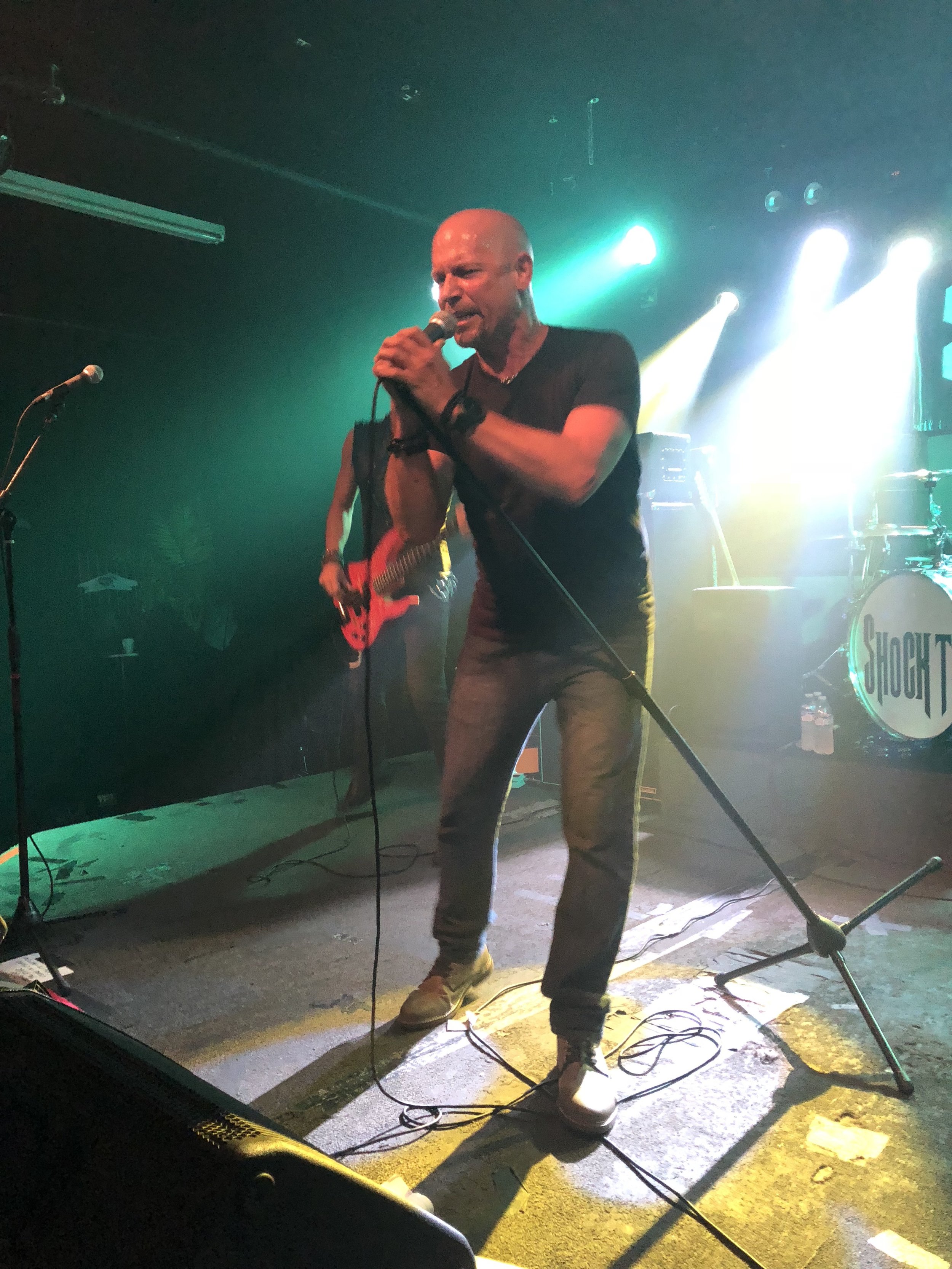
A pic of me with Chip Z'nuff and Derek Frigo. A band I was in got to open a show for them during their tour of their debut album. RIP Derek.
Scott Carr is a guitarist who plays in the Columbus, OH bands Radio Tramps andReturning April. Scott is also an avid collector of vinyl records and works at Lost Weekend Records. So...if you are looking for Scott....you'll either find him in a dimly lit bar playing his guitar or in a record store digging for the holy grail.